TS
tingtingjahe
India Bangun Pelacak Satelit di Vietnam, Bisa Awasi Tiongkok!
New Delhi/Hong Kong (ANTARA News) - India akan memasang sebuah pusat pelacakan satelit dan pencitraan di Vietnam selaan yang akan membuat Vietnam mendapatkan akses ke foto-foto dari satelit observasi bumi milik India yang mencakup wilayah itu, termasuk Tiongkok dan Laut Tiongkok Selatan, kata para pejabat India seperti dikutip Reuters.
Langkah yang akan membuat Beijing meradang ini bakal mempererat hubungan antara India dan Vietnam yang keduanya memiliki sengketa wilayah berkepanjangan dengan Tiongkok.
Kendati merupakan fasilitas sipil --satelit pengamatan bumi biasanya memiliki aplikasi pertanian, keilmuwan dan lingkungan--, para pakar keamanan mengatakan teknologi pencitraan yang lebih canggih akan membuat foto-foto yang dihasilkan bisa digunakan juga untuk tujuan-tujuan militer.
Hanoi secara khusus memburu teknologi maju intelijen, pengamatan dan pengintaian di tengah meningkatnya ketegangan dengan Tiongkok menyangkut Laut Tiongkok Selatan, kata mereka.
"Dari segi militer, langkah ini bisa amat penting," kata Collin Koh, pakar keamanan laut pada S. Rajaratnam School of International Studies, Singapura. "Tampaknya keduanya sama-sama menang, Vietnam bisa mengisi lubang-lubang penting, sedangkan India dapat memperluas jangkauan."
Perusahaan milik pemerintah Indian Space Research Organisation (ISRO) akan mendanai dan membangun pusat pelacakan satelit dan penerima data ini di Ho Chi Minh City untuk memonitor peluncuran satelit India. Proyek ini ditaksir bernilai 23 juta dolar AS.
India yang program luar angkasanya sudah berumur 54 tahun dan tengah mempercepat diri lewat kebijakan satu satelit diluncurkan setiap bulan, memiliki stasiun-stasiun daratan di Kepulauan Andaman dan Nicobar, Brunei, Biak di Indonesia Timur, dan Mauritius, yang dapat menjejak satelit-satelitnya pada tahap-tahap awal penerbangan.
Fasilitas di Vietnam ini akan meningkatkan kemampuan-kemampuan itu, kata Deviprasad Karnik dari ISRO seperti dikutip Reuters.
Editor: Jafar M Sidik
Sumber
Berita Asli dari Reuters.
India to build satellite tracking station in Vietnam that offers eye on China
India will set up a satellite tracking and imaging centre in southern Vietnam that will give Hanoi access to pictures from Indian earth observation satellites that cover the region, including China and the South China Sea, Indian officials said.
The move, which could irritate Beijing, deepens ties between India and Vietnam, who both have long-running territorial disputes with China.
While billed as a civilian facility - earth observation satellites have agricultural, scientific and environmental applications - security experts said improved imaging technology meant the pictures could also be used for military purposes.
Hanoi especially has been looking for advanced intelligence, surveillance and reconnaissance technologies as tensions rise with China over the disputed South China Sea, they said.
"In military terms, this move could be quite significant," said Collin Koh, a marine security expert at Singapore's S. Rajaratnam School of International Studies. "It looks like a win-win for both sides, filling significant holes for the Vietnamese and expanding the range for the Indians."
The Indian Space Research Organisation (ISRO) will fund and set up the satellite tracking and data reception centre in Ho Chi Minh City to monitor Indian satellite launches, the Indian officials said. Indian media put the cost at around $23 million.
India, whose 54-year-old space programme is accelerating, with one satellite launch scheduled every month, has ground stations in the Andaman and Nicobar islands, Brunei, Biak in eastern Indonesia and Mauritius that track its satellites in the initial stages of flight.
The Vietnam facility will bolster those capabilities, said Deviprasad Karnik, an ISRO spokesman.
QUID PRO QUO
But unlike the other overseas stations, the facility will also be equipped to receive images from India's earth observation satellites that Vietnam can use in return for granting India the tracking site, said an Indian government official connected with the space programme.
"This is a sort of quid pro quo which will enable Vietnam to receive IRS (Indian remote sensing) pictures directly, that is, without asking India," said the official, who declined to be identified because he was not authorised to speak to the media.
"Obviously it will include parts of China of interest to Vietnam."
Chinese coastal naval bases, the operations of its coastguard and navy and its new man-made islands in the disputed Spratly archipelago of the South China Sea would be targets of Vietnamese interest, security experts said.
Another Indian official said New Delhi would also have access to the imagery.
India has 11 earth observation satellites in orbit, offering pictures with differing resolutions and areas, the ISRO said.
Indian officials had no timeframe for when the centre would be operational.
"This is at the beginning stages, we are still in dialogue with Vietnamese authorities," said Karnik.
Vietnam's Foreign Ministry confirmed the project, but provided few other details.
China's Defence Ministry said the proposed tracking station wasn't a military issue. The Chinese Foreign Ministry had no immediate comment.
Vietnam launched its first earth observation satellite in 2013, but Koh said it was not thought to produce particularly high resolution images.
BLURRED LINES
Security experts said Vietnam would likely seek real-time access to images from the Indian satellites as well as training in imagery analysis, a specialised intelligence field.
"The advance of technology means the lines are blurring between civilian and military satellites," said Trevor Hollingsbee, a retired naval intelligence analyst with Britain's Defence Ministry. "In some cases, the imagery from a modern civilian satellite is good enough for military use."
Sophisticated military reconnaissance satellites can be used to capture military signals and communications, as well as detailed photographs of objects on land, capturing detail to less than a metre, Koh and other experts said.
The tracking station will be the first such foreign facility in Vietnam and follows other agreements between Hanoi and New Delhi that have cemented security ties.
India has extended a $100 million credit line for Hanoi to buy patrol boats and is training Vietnamese submariners in India while Hanoi has granted oil exploration blocks to India in waters off Vietnam that are disputed with China.
Under Prime Minister Narendra Modi, India has shown a greater willingness to step up security ties with countries such as Vietnam, overriding concerns this would upset China, military officials said.
"You want to engage Vietnam in every sphere. The reason is obvious - China," said retired Indian Air Force group captain Ajay Lele at the New Delhi-based Institute for Defence Studies and Analyses.
Both India and Vietnam are also modernising their militaries in the face of Beijing's growing assertiveness, having separately fought wars with China in past decades.
Australian-based scholar Carl Thayer, who has studied Vietnam's military since the late 1960s, said the satellite tracking facility showed both nations wanted to enhance security ties.
"Their interests are converging over China and the South China Sea," he said.
(Additional reporting by Megha Rajagopalan in Beijing and Ho Binh Minh in Hanoi; Editing by Dean Yates)
Reuters
Wow, seperti apa ya teknologinya? LCS tambah panas dong, lebih banyak kepentingan yang ikut ^^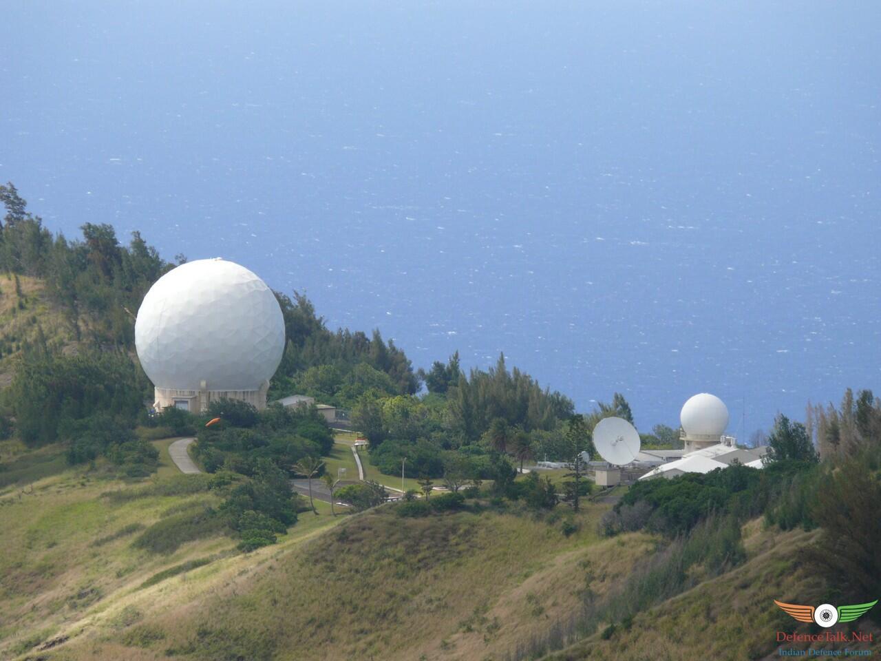
0
2.6K
1
Thread Digembok
Mari bergabung, dapatkan informasi dan teman baru!
Militer
20KThread•7.3KAnggota
Urutkan
Terlama
Thread Digembok